
The Greater Outdoors
PC Jack Thompson/The Wildlands Conservancy
Pioneertown Ranch has really good neighbors. Our striking backdrop isn’t just any old mountain range. But the protected 25,000-acre nature preserve owned by California non-profit The Wildlands Conservancy. The Conservancy’s Pioneertown Mountains Preserve directly borders Pioneertown Ranch, offering 18+ miles of hiking in two different trail loop systems. So, pack your boots. Here, Ranger Kerry Puckett takes us on a hike.
Quick Facts
Size: 25,000 acres (that’s 39 square miles!)
Dog friendly: Yes, on a leash please (for their safety- cactus is no joke)
Cost: Free, though the conservancy operates on donations
Hours: Dawn to dusk, 365 days a year
Address
51010 Pipes Canyon Road, Pioneertown, CA 92268
Phone: 760-369-7105
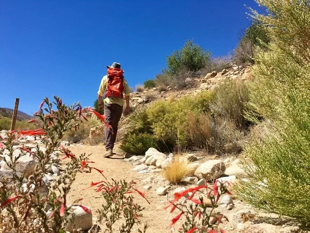
California Fuchsia trailside in Pipes Canyon late spring

Pipes Canyon trailhead with snow capped mountains in the distance
Pipes Canyon Trail to The Olson Ruins
Length: 3.5 miles (out and back)
Starts From: Pipes Canyon Ranger Station area
Difficulty: Easy
The Pipes Canyon Trailhead offers a popular, mellow hike up a classic desert wash. Visitors in the cooler months will be treated to snow capped peaks in the distance while making their way towards a natural spring that feeds a riparian wetland roughly a mile up canyon from the trailhead. Hikers will encounter beautiful willow trees arching over the trail, and the remnants of a 1930’s era homestead cabin built by a retired miner. Visitors in late April through early June will be treated to seasonal wildflower displays trailside. Adventurous hikers may continue past the ruins to complete the 6.5 mile “Indian Loop” (moderate-difficult).
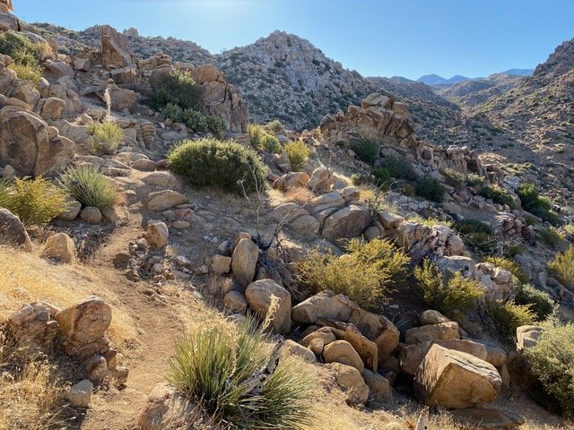
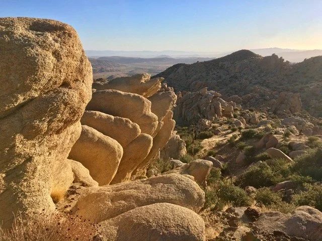
Chaparrosa Peak trail flows through stunning Quartz Monzonite boulders
Trailside views a mere 3/4 of a mile up trail

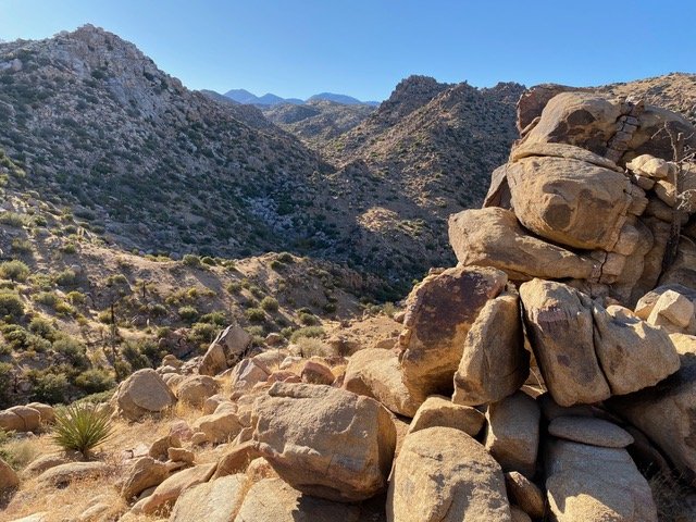
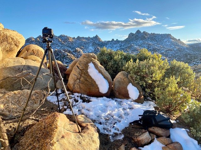
Chaparrosa Peak Summit looking toward Mt San Jacinto in the distance
Trailside views towards the Sawtooth Mountains just below the peak
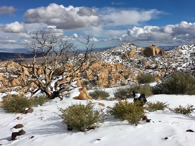
At 5,541’ in elevation, winter visitors are often treated to snow in the desert at Chaparrosa Peak after rain events
Chaparrosa Peak Trail
Length 6.6 miles (out and back)
Starts From: Upper Parking area at the Pipes Canyon Ranger Station
Difficulty: Moderate to difficult
Elevation gain: 1,082 feet
At 5,541' feet in elevation, Chaparrosa Peak is the tallest peak in the front rage west of Pioneertown. This trail climbs almost 1,100’ over 3.3 miles, offering stunning views of the desert (and looks down on Pioneertown Ranch) and rock formations along the way. This direct route to Chaparrosa Peak will get the heart pumping and reward you with 360 degree views for miles at the top. For those looking for a longer hike, the peak is also accessible from the 6.5 mile Indian Loop via a 3/4 mile spur trail off of the loop.
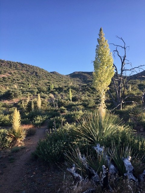
Pictured here is a stunning Nolina display during spring 2021
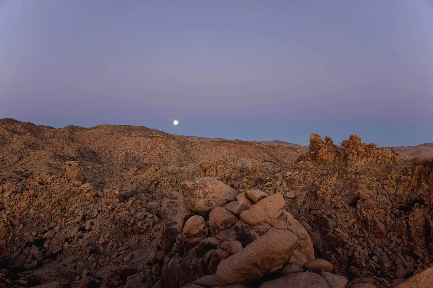
Freeze Frame: The iconic Sawtooth Ridgeline offers hikers and landscape photographers a vast natural wonderland
Sawtooth Trail
This 10.5 mile loop trail is not for the faint of heart. Those up for the challenge will be rewarded with stunning rock formations on par with what you’ll experience in the national park. Pack plenty of water and be prepared to spend at least a half-day experiencing this natural wonderland.
While the majority of the preserve’s stunning Pinyon, Juniper, and Joshua trees were lost during the 2006 Sawtooth fire, lush scrub oak, desert almond, catclaw, manzanita now dominate the landscape and spring wildflower displays are spectacular following a rainy winter.
Want more stories like this?
Archive West publishes bi-monthly. Get on our radar. Sign up.